Broomhall Street: A main street full of shops
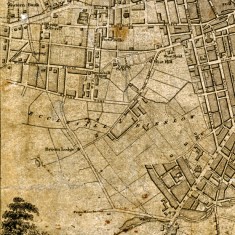
Broomhall Street has all but disappeared in the present Broomhall landscape (see google map below). It is said locally that it used to be the main road into town and ran along the old estate road into town from the Broom Hall house. At one time it was called Black Lambs Lane and later Broomhall Lane (see 1822 map above). On later maps in the 1800s it is called Broomhall Street and ran from West Street (near the Tesco) right down to Broomhall Road and on one map along part of Sunnybank.
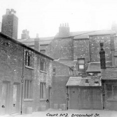
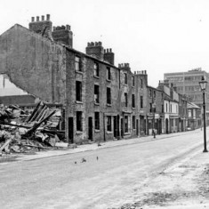
The street used to be full of back-to-back houses and courts with hundreds of shops along the front.
What remains of it today is in three sections:
1. From West St near Tesco down the pedestrian path next to Within Reason.
It then disappears into the footpath on Devonshire Green towards Fitzwilliam Street.
2. There it picks up again for a short section up to the entrance of Springfield School, at the bottom of Cavendish Street.
It then disappears again under the current Springfield Estate (formerly the site of the Broomhall flats).
3. It re-emerges the other side of the ring road near St Silas church and ends up the hill at the junction of Broomhall Road and Wharncliffe Road and Broomhall Place.
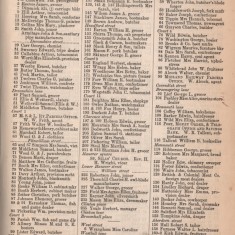
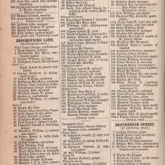
The trade directories give us a fascinating insight into how busy it must have been in the past. See the shops on Broomhall Street in 1891 in the directory pages above.
In the 1960s most of Broomhall Street was demolished as part of the slum clearances.






No Comments
Add a comment about this page